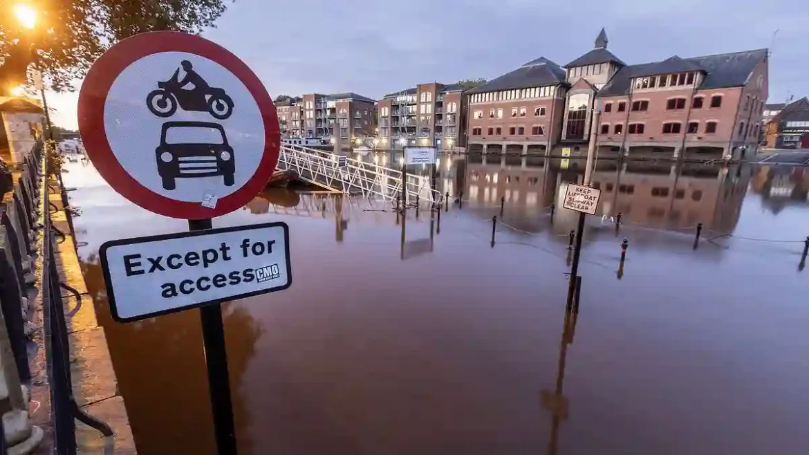
After a turbulent week of intense rainfall and gusty winds, it looks like the UK isn’t getting a break just yet.
As temperatures dip to freezing levels in Scotland, and flooding continues across parts of England, the Met Office has now issued another warning for strong winds reaching up to 60 mph.
Summer Has Officially Left the Building
It’s safe to say that the warmth of summer is now behind us.
Across parts of England, heavy downpours have caused significant flooding, especially in the South and Midlands.
With more than double the usual rainfall for September, homes have been inundated, and daily commutes have been thrown into chaos.
While the amber weather warning for rain has just lifted, residents are being urged to brace themselves for what’s coming next: powerful winds.
A yellow wind warning is in effect for areas in southwest England and Wales starting tomorrow.
Time to Break Out the Winter Gear
For those in Scotland, the frosty weather has already arrived.
This morning, temperatures plummeted to as low as -1°C, with the Met Office advising people to “search for a thicker duvet.”
Thanks to a northerly airflow, many across the country woke up to a blanket of frost.
Today’s forecast looks a little brighter with drier conditions expected, although some showers may still pop up around northern and eastern coasts.
A Windy and Wet Sunday Ahead
Sunday’s weather is shaping up to be a mixed bag. Many areas will start off dry and pleasant, but that won’t last long.
Winds will pick up strength throughout the day, moving from west to east, bringing gusts of up to 60 mph in exposed areas.
Alongside the wind, rain showers are expected, some of which could be heavy, leading to potential road hazards with surface water and spray.
Coastal Disruptions and Transport Delays
For those living or traveling near the coast, be prepared for large waves and strong winds that may cause disruption to ferries, buses, and train services.
Coastal routes and seafront communities might see delays due to spray and flooding.
Though winds will ease across Wales and southwest England by Sunday night, southern coastal areas could remain gusty.
Flooding and Damage Across the UK
Earlier this week, heavy rain and flash floods wreaked havoc in several regions, particularly Bedfordshire, Northamptonshire, and the home counties.
About 650 homes were flooded, and nearly 8,200 properties were spared thanks to flood defenses, according to the Environment Agency.
The worst-hit areas, including Milton Keynes and Oxfordshire, experienced 30-40 mm of rain in just three hours.
Travel Disruptions Continue
Severe flooding has also led to widespread travel chaos.
Rail services between Shrewsbury and Wolverhampton were canceled, and flooding at Wellington station left the Telford United football stadium under water.
In Bedfordshire, the Marston Vale line between Bedford and Bletchley is out of action until Monday due to standing water on the tracks.
Meanwhile, the M5 in Gloucestershire faced closures due to flooding, causing hour-long delays and congestion.
What’s Next?
While the weather looks set to improve briefly, with drier conditions expected tomorrow, the combination of strong winds and rain means the UK isn’t out of the woods yet.
Coastal areas remain at risk, and travel disruptions could continue into next week.
Stay prepared and keep an eye on updates from the Met Office as the weather evolves.
Mine Crypto. Earn $GOATS while it is free! Click Here!!